City to unveil story map of the properties on its Register of Historic Places
![]() Residents are invited to join Development Services Department staff on a digital tour of Walla Walla’s historic places. The unveiling of the Historic Register Story Map will take place at 5:30 p.m. on Aug. 8, 2024, in the City Council Chambers at City Hall, 15 N. 3rd Ave. The public is invited to attend in person or via Zoom at us02web.zoom.us/j/88330259334.
Residents are invited to join Development Services Department staff on a digital tour of Walla Walla’s historic places. The unveiling of the Historic Register Story Map will take place at 5:30 p.m. on Aug. 8, 2024, in the City Council Chambers at City Hall, 15 N. 3rd Ave. The public is invited to attend in person or via Zoom at us02web.zoom.us/j/88330259334.
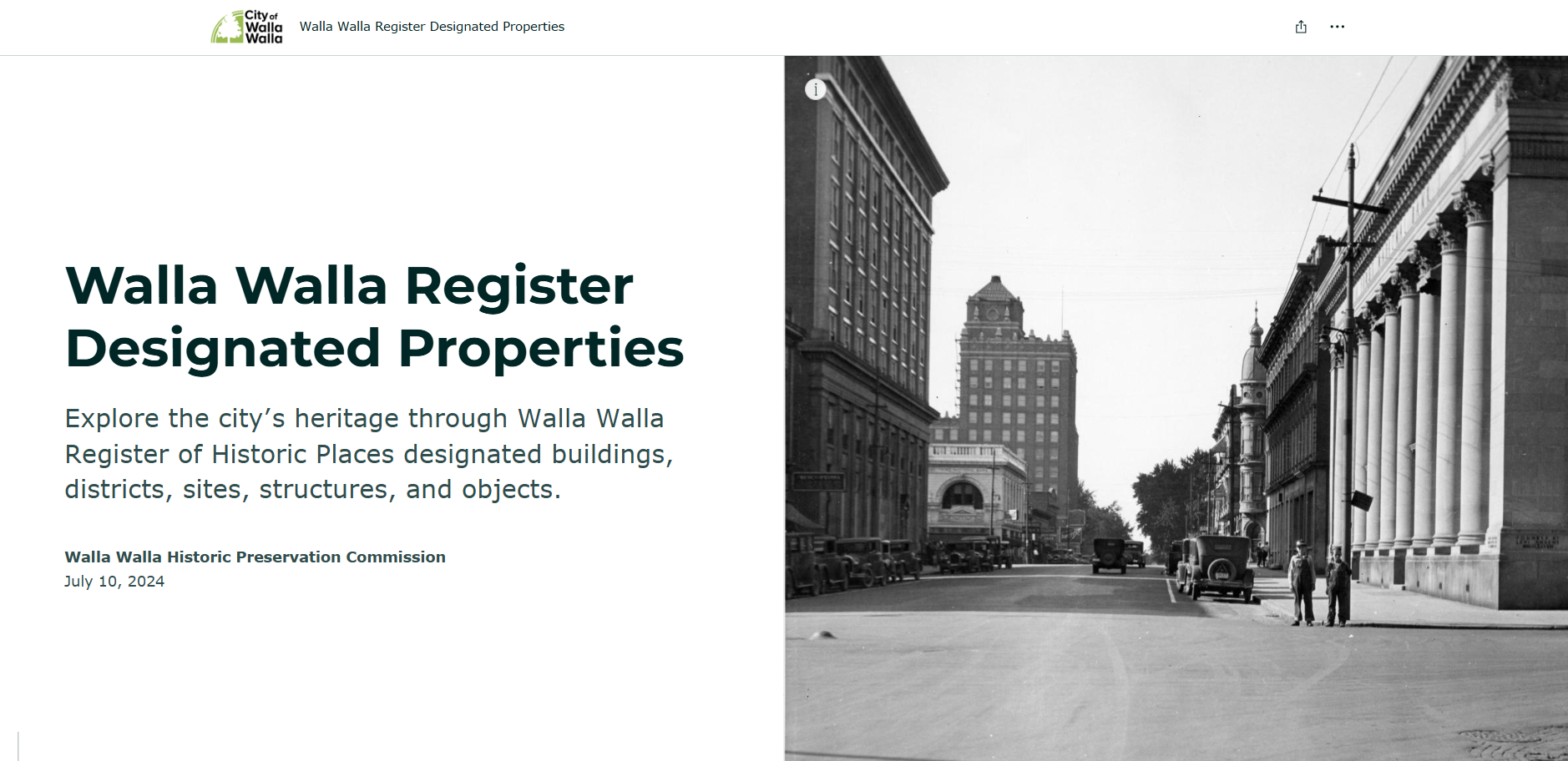
Screen capture of site’s opening image, Aug. 6, 2024
In 2023, the city of Walla Walla received a Certified Local Government Historic Preservation Grant to create a GIS (Geographic Information Systems) story map of the city’s Register of Historic Places. The city’s Development Services Department and GIS Division enlisted Northwest Vernacular, a historic preservation consultant, to transition the current spreadsheet of properties to a story map — an engaging and interactive tool.
“It is exciting to see this story map come to fruition and to hopefully be an engaging and easy-to-use tool for residents and others to explore and learn about the city’s Register of Historic Places,” said Lisa Wasson-Seilo, planner in the Development Services Department. “The local register currently lives in a static spreadsheet, so this interactive story map is a big step forward in terms of usability and transparency of our local register properties.”

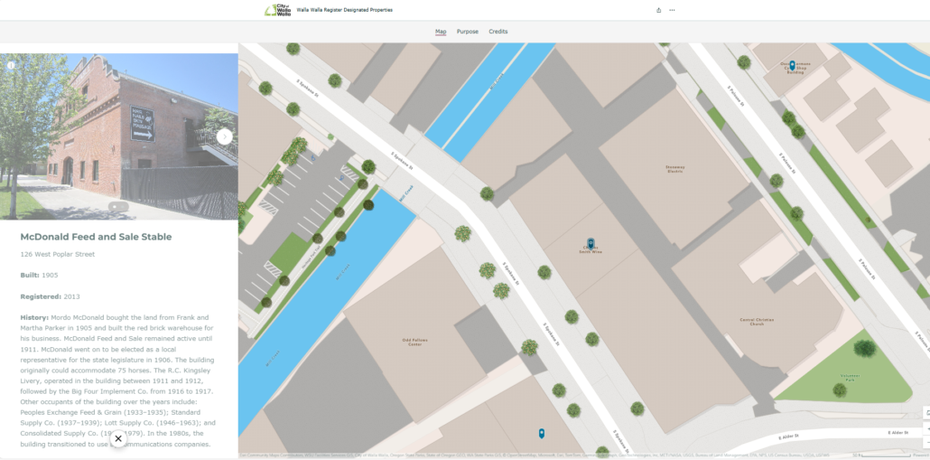
Screen capture of sample map location, Aug. 6, 2024
Staff are still finalizing the project and welcome questions and comments. Their hope is that by exploring the story map, residents will gain a deeper appreciation of Walla Walla’s historic places.
Anyone with questions about the city of Walla Walla’s Historic Preservation Program may contact Wasson-Seilo at lwasson-seilo@wallawallawa.gov or 509-524-4717.


