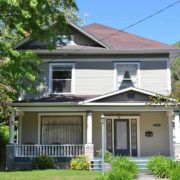
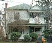
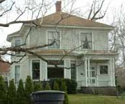
History of 528 University Street, Walla Walla, WA – Tekisuijuku (Japanese House), Whitman College
Legal Description
Beginning at the point of intersection of the Southerly line of University Street in the City of Walla Walla, Washington, with the Easterly line of Stanton Street in said City; thence Southerly along the Easterly line of Stanton Street in said City; thence Southerly along the Easterly line of Stanton Street to the point of intersection of same with the center line of Isaacs’ Brook; thence Easterly along the center line of said Isaacs’ Brook to the junction of the streams; thence Northeasterly along the center line of the Northerly branch of said stream to its intersection with the East line of Section 20 in Township 7 North Range 36 East of the Willamette Meridian; thence North along the East line of said Section 20 to the Southerly line of University Street aforesaid; thence Westerly along the Southerly line of University Street to the point of beginning.
Title & Occupant History
Washington Territory was created in 1853. The new legislature created Walla Walla County in 1854 which stretched from the crest of the Cascade Mountains to the crest of the Rocky Mountains in the present states of Washington, Idaho and Montana. In 1855 a treaty council was held on the banks of Mill Creek at the present site of Walla Walla to purchase land from the Indians. The Yakimas, Cayuses and Walla Walla Indians were dissatisfied with the treaties and war followed. Missionaries, former French-Canadian employees of the Hudson Bay Company trading post at Wallula, and soldiers at the military Fort Walla Walla were the primary European occupants of the area prior to 1859 when it was opened for settlement. All of the land in this area was acquired from the Cayuse and Walla Walla Indian tribes by the U.S. Government in a treaty signed on June 9, 1855 in Walla Walla, and ratified on March 8, 1859 by President James Buchanan.
Walla Walla was originally laid out by County Surveyor H. H. Case in 1859, before its formal incorporation as a city in 1862, as a one-quarter mile square with its eastern side centered on the point where Main Street crossed Mill Creek (at roughly the point where it does now). The City of Walla Walla received a Trustee Townsite from the U. S. Government which consisted of 80 acres issued on July 20, 1869 by the Vancouver, W.T. District Land Office. Main Street originally followed the old Nez Perce Indian Trail. Consequently the streets leading off of it were at right angles to it, and were not in a north-south orientation. This was corrected as the city moved eastward which gave Walla Walla its peculiar street pattern with the three street intersection at Palouse, Boyer and Main Streets. To the original plat, additional parcels were annexed from time to time, usually bearing the name of the land owner of record at the time the additions were made.
The earliest land transaction in this part of Walla Walla was on May 23, 1863 when John Haley sold 12 properties to William H. Patten and wife for $100. On January 20, 1864 William H. and Elizabeth A. Patten sold 80 acres to H. P. Isaacs for $2000. Henry Perry Isaacs was a dominant figure in the development of southeast Washington. In 1862 he built the North Pacific Mills in Walla Walla. H. P. Isaacs started several flour mills in eastern Washington, in Idaho, and in eastern Oregon (1858 in Ft. Colville; 1862 in Walla Walla; 1864 in Boise; 1865 in Middleton, Idaho; 1883 in Prescott; and 1898 in Wasco, Oregon). W. D. Lyman referred to him as the foremost miller on the Pacific coast” in his History of Walla Walla County. He developed an export market to China for his flour. He also successfully experimented with almost every variety of fruit and vegetable grown in the northern temperate zone and was a “booster” for Walla Walla, encouraging rail lines in the valley and introducing the bill that established the state penitentiary in Walla Walla.
On September 21, 1881, H. P. and Lucie Fulton Isaacs leased 80 acres in Sections 20 and 21, Township 7 N., R. 36 E.W.M. to J. C. Isaacs for 25 years from September 21, 1881, for $10,000, to use the subterranean waters on and in the land “for the – purpose of supplying the City of Walla Walla and the inhabitants thereof with water.
On June 23, 1894 Lucie Isaacs signed a Quit Claim Deed giving all her interest to Henry P. Isaacs, her husband, for $1. On March 28, 1896 H. P. and Lucie Isaacs sold their extensive water rights to Miles C. Moore, W. W. Baker and H. C. Baker, Trustees for the Dorsey S. Baker Estate, for $20,000. On November 28, 1899 the trustees sold the water rights to the city of Walla Walla for a stated amount of $1. H.P. Isaacs died in 1900 without a will.
On March 18, 1901 A. J. Patten gave a statement to the heirs of H. P. Isaacs to clarify the 1864 deed. On March 30, 1901 the City of Walla Walla passed an Ordinance specifying the route of water from the Isaacs mill race. On November 11, 1901 Bessie (Isaacs) Savage, Charlotte M. (Isaacs) Doheny, Grace Isaacs, J. P. Isaacs and Edwin Isaacs signed a Quit Claim Deed giving all their interests in this property back to their mother, Lucie. Lucie Stanton Isaacs was very involved in the development of this community. She was active in the Walla Walla Ladies’ Park Club, Art Club, Reading Club and symphony (hosted the first meeting). She and her husband were supporters of women’s suffrage. Susan B. Anthony stayed in their home in 1871.
On November 21, 1905 Lucie Isaacs gave a warranty deed to her daughter-in-law, Eloise Leonard Isaacs, for this property. Carrie Eloise ha graduated from Mills College in 1894. Her husband, Edwin Stanton Isaacs, was listed as an “irregular” student in Whitman College’s “scientific and literary” department in 1889. He managed his father’s considerable interests after his father’s death. Edwin Isaacs was also president and general manager of the Walla Walla City Railway Company. In 1902 they had 6 miles of electric railway under construction. The 1905 Sanborn Firemap shows a house on this property with an apparent front porch facing east, in the direction of Lucy Isaacs’s home. There was no Stanton Street at this time. The two Isaacs homes occupied a lot filled with vineyards and orchard that was bordered by Boyer Avenue, North Clinton, University and Brookside Way (vacated in 1906), located west of the amphitheater on the Whitman campus.
On May 26, 1919, Edwin Stanton Isaacs and his wife Eloise Leonard Isaacs sold this residence to Matilda Preston. Mrs. Preston was the widow of William Preston, owner of the Waitsburg flour mill. Eloise’s Leonard family was also involved in the Preston Mill in Waitsburg.
On September 17, 1929 Matilda Preston’s Estate sold this home to John C. Lyman. He was born in 1885, raised in Columbia County, “on the breaks of the Whetstone” and attended Whitman College and John Hopkins Medical School. After medical school he served in the British Army in France prior to the U.S. entry into World War I. Following his marriage he moved to Walla Walla to establish his medical practice in partnership with Drs. Whitney and Falconer. On December 10, 1946 he deeded this property to his daughter, Elizabeth W. Robison, who was married to Eugene Robison. Mrs. Robison died on July 11, 1982 and willed an undivided interest in this property to her children, Linda, Peter and Ann. Linda and Peter transferred their interests to Ann and her husband Norm Passmore in 1986. On November 30, 1987 Norm and Ann Robison Passmore sold this home that had been in their family for 58 years to Whitman College Board of Trustees.
Construction of Building
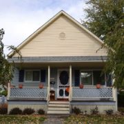
H. P. Isaacs purchased 80 acres in this neighborhood in 1864. Over the next forty years they platted this property, sold lots in subdivisions and built several homes on lots adjacent to their residence at 553 Boyer (now designated as 100 Brookside Drive), at which all members of the family were living in 1902. Edwin was listed in the 1904 city directory as living at 551 Boyer, a possible error. Edwin’s house at 528 University was shown in the 1905 Sanborn Firemap, facing east toward H.P. Isaacs’s 1865 (extensively remodeled in 1886) home. On March 14, 1908 Edwin S. Isaacs took out a building permit for “one and a half story cottage improvements” at an estimated cost of $2500. The 1909 fire map shows a house of the same dimensions with a porch facing north toward the new University Street. The bay window now appeared to be on the east side of the house, as if the house had been rotated a quarter turn. It is probable that the house was turned to face the new University Street. The current house has a basement and a fireplace adjacent the bay window, which might have been added during the extensive improvements. The cost of these improvements was about the same as other homes in the neighborhood constructed by the Isaacs family (Grace Isaacs’s home at 945 University had a construction permit for $2600). The Robison family added the garage, an enlarged kitchen and a closet adjacent the front door during their tenure in this house.
No fire maps show this property before 1905 because it was outside the city limits. The 1905 city directory lists Edwin S. Isaacs as living on the south side of University west of Clinton. In 1907 he was listed at 548 University(and at 572 in 1920). The house was listed at its present 528 University in 1953. Therefore this house had to be constructed prior to 1905 but probably not before 1904. The Walla Walla Tax Assessor’s records state a1901 construction date.
References
Ancestry.com
American Street Railway Investments, Vol. 10, 1902
Andres, Penny, Walla Walla Her Historic Homes, Vol. I, 1991. p.18.
Bennett, Robert A., Walla Walla A Town Built to be a City 1900-1919, Pioneer Press, Walla Walla, 1982
Building Permits: Whitman College Penrose Library Archives.
Lyman, Professor W.D., An Illustrated History of Walla Walla County, W. H. Lever, publisher, 1901.
Sanborn Fire Maps: 1884-1905 (with updates until 1950).
Walla Walla City Directories: 1880-present (various publishers–not all years).
Whitman College Archives.
Whitman College catalog, 1889
Mary E. Meeker, Researcher Walla Walla 2020 Research Service P.O. Box 1222, Walla Walla, WA 99362 March 2014

