Welcome to the Upper Mill Creek History Website
Marcus Whitman Saw Mill
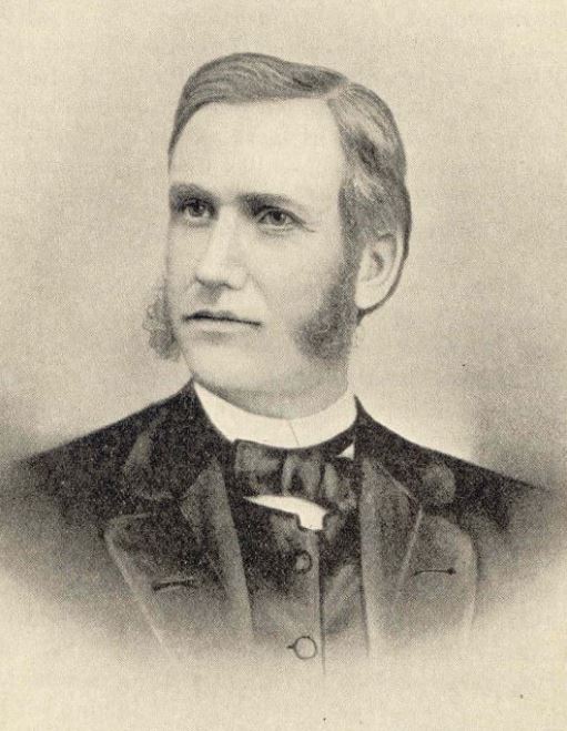
Marcus Whitman, illustration from How Marcus Whitman Saved Oregon, by O.W. Nixon, 1895
The first Euro-Americans to occupy the Upper Mill Creek area above Walla Walla worked at a saw mill erected by Presbyterian missionary Marcus Whitman in 1845.
In an April 8, 1845 letter, Whitman wrote: “Partly in order to give employment to those who wintered with us, but more from the necessity of having boards and timber for the use of the (Mission) and… to supply fencing for ourselves and the Indians, I have been building a saw mill…The mill is about twenty miles off in the Blue Mountains where we have an abundance of timber—and a fine (location) with a good road to reach it.
Whitman also erected a log cabin at the mill, where in later years some of the immigrants who were wintering at the mission were able to stay. During the winter of 1846-47, three families and five single men lived at the sawmill.
During seasons the Indians were away on expeditions for food and had to leave unattended the fields Marcus Whitman had encouraged them to plant, their crops were often destroyed by wandering horses and cattle. To assist them, Whitman wrote on May 19, 1847 of “getting near 20 thousand rails split for them & I hope to plough additional prairie for them as much as they could fence.”
At the time of the Whitman Massacre on November 29, 1847, there were 11 people from two families residing at the sawmill. A sign along upper Mill Creek Road about a half mile above Scenic Loop marks the probable location of the mill.
Second Walla Walla Treaty Council & Stevens Skirmish

Chief Kamiakin, by Gustav Sohon
In an attempt to end the Indian war that had broken out after the Treaty Council of 1855, Washington Territorial Governor Isaac Stevens again called all the inland tribes to Walla Walla in September of 1856. Failing to convince them to surrender either their lands or their arms, Stevens and his party were attacked as they attempted to return to The Dalles.
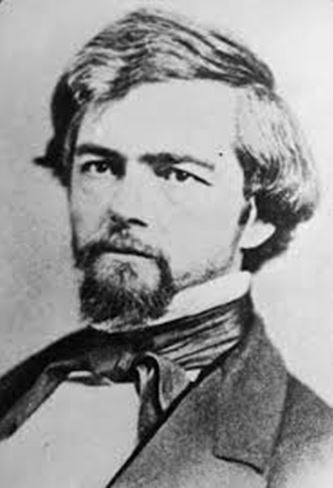
Isaac I. Stevens
The initial attack led to fighting in the upper Mill Creek area throughout the afternoon and night of September 19, 1856, and into the following day. This skirmishing was the only instance of combat with Indians by Stevens, who later died as a general in the US Army during the Civil War.
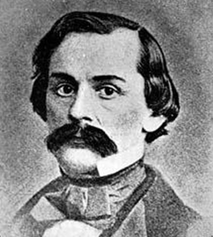
Edward J. Steptoe
A contour map placing each of these points on the ground in the Rooks Park- Bennington Lake vicinity, together with first person accounts by participants in these events is available online, along with the text of an interpretive sign placed by Walla Walla 2020 along the south levee of Mill Creek just above the Yellowhawk-Garrison Creek diversion dam. An additional sign has been placed on Five-Mile Road.
William Davies Community
Many of the early settlers along upper Mill Creek had been members of the 1860s religious community led by William Davies known as “The Kingdom of Heaven” overlooking the Walla Walla Valley. The history of the Davies community is told in a Walla Walla 2020 interpretive sign located at the corner of Scenic Loop Road and Mormon Grade.
Mill Creek Flume & Railroad
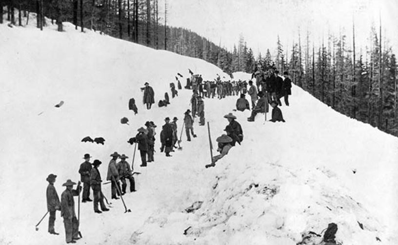
In 1880, Dr. Dorsey S. Baker began work to realize his long-held vision of providing Walla Walla with an adequate supply of wood for fuel and lumber. From 1880-81, approximately 200 Chinese laborers camped in what is now known as China Canyon, while working to construct a lumber flume and railroad for the Mill Creek Flume and Manufacturing Company organized by Dr. Baker.
The company purchased a small saw mill that had been established just above the mouth of Tiger Canyon, together with the main body of timber in the watersheds of Henry, Webb, China and Tiger canyons, amounting to about 4000 acres. The mill was rebuilt with new saws and other equipment, and a dam was constructed with a water wheel to furnish power. A portable steam mill was later installed at the forks of the right-hand of Tiger Canyon and moved to other canyons as needed.

Building of the Mill Creek Flume & Railroad article, June 13, 1944, Walla Walla Union-Bulletin
The 12-mile main flume had 32 inch sides with a V-flume 3½ feet across, and required many trestles and several cuts to reach its terminus at Dudley, originally named for the construction crew chief and now called Tracy. There the wood emptied into a reservoir, and was cut and loaded onto Baker’s new narrow gauge railroad, which took it to town. A nearby grove soon became Walla Walla’s favorite picnic ground, and excursions on the little railroad became regular affairs.
There was also a mile of 2 foot flume up Henry Canyon; another 2½ miles up Tiger Canyon, a little more than a mile up China Canyon, and a 1¼ mile flume up the left fork of Tiger Canyon.
The China Canyon flume was built a year following the finishing of the railroad, but the day after completion a cloudburst washed out much of the main flume and all the flumes in the side canyons, burying the portable mill under 30 feet of debris. Although all were rebuilt, the next year a second freshet took out all the flumes in the side canyons, and shortly after that the boiler of the Webb canyon mill blew up, bringing an untimely end to the operations of the company.
In 1882, a branch of the narrow gauge line had been built from a point two miles below its Mill Creek terminus to the village of Dixie, then known as Baker City. Clay from the quarry there was shipped to the penitentiary for brick-making, along with wheat, several other products, and some passengers. By 1890, control of the railroad had passed to the Oregon Rail & Navigation Company, then on to the Union Pacific, to the Northern Pacific which converted it to standard gauge, and ultimately to the Burlington Northern, which closed the line in 1970.
The Klicker Springs Hotel & Spa
Klicker Springs Hotel & Spa
Almina Garland, a widow, arrived in the Walla Walla area in 1891, and homesteaded 160 acres along Mill Creek. After marrying Jake Klicker, Almina built the Klicker Springs Hotel & Spa at the mouth of Henry Canyon, with help from her uncle Jimmy Woodyard. A steady stream of mineral spring water was piped from the mineral springs across Mill Creek for use in the hotel’s bathhouses. The spring water was rich in sulphur, soda, iodine and iron; as a result it was also used to make a variety of spritzers and soda drinks that became popular in Walla Walla.
The hotel building was located on present-day Straw Spring Lane, previously known as Cold Springs. In about 1919, the old frame hotel was torn down and a new log building was constructed across the road on the site of the resort campground. This building served as the Klicker Springs Hotel until the mid-1920’s when it closed, and the log structure became the Klicker home place, which is still standing.
In the early 1900’s Almina helped establish a school next to the hotel, called the Klicker School, which offered classes from first through eighth grade. Since it was not feasible for families living in the Mill Creek area to commute all the way to Walla Walla for their education, the one-room school was a welcome amenity for the Mill Creek community.
Camp Kiwanis
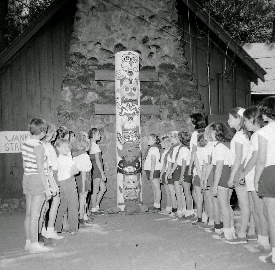
Camp Fire girls at Camp Kiwanis, July 23 1957. File photo courtesy of the Walla Walla Union-Bulletin.
Camp Kiwanis was established in 1923 on four acres of land lying 13 miles from Walla Walla along Mill Creek Road by the Walla Walla Kiwanis Club a year following the club’s founding. The land was purchased from Harry and Allen Reynolds for $400. First opened as a camp for girls in close cooperation with the Campfire Girls, before long the facility was made available for nonprofit use by young people regardless of their gender.
Another four acres were added later, an initial lodge was built, together with cabins and a swimming pool, and access to several additional acres of mountain lands for hiking was provided.
Over the years, the original footbridge over Mill Creek has had to be replaced, the lodge burned down in 1990 and had to be replaced with a larger structure, and other improvements have been made.
Camp Kiwanis was originally operated solely by the Walla Walla Kiwanis Club and later by several regional Kiwanis Clubs. In the 1970s the Camp Kiwanis Foundation was expanded to include representatives of other community organizations.
Camp Kiwanis has brought recreation and wholesome outdoor sport to generations of area youngsters, and will hopefully continue to do so for future generations.
The Kooskooskie Cabin Community
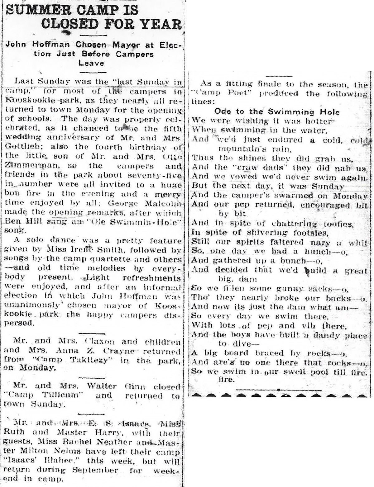
Kooskooskie Park article, September 10, 1916, Walla Walla Union-Bulletin
For many years prior to the construction of the first cabins at Kooskooskie, the land where the future cabin would be built along Mill Creek had been owned by the City of Walla Walla for use in its water supply system, and the City had issued permits for camp spaces at Kooskooskie Park, a popular recreation site for the community.
The first cabins built by permit holders appear to have been erected before 1920, with a majority of the cabins being added in the 1930s. Until 1965 when formal leases were issued for the first time with an annual rental of $50 including water, cabin owners held only permits issued for an even smaller fee.
In 1974, in response to a proposal by Walla Walla County for the establishment of a 317-acre county park adjoining the cabin community, cabin owners organized opposition to the idea of a public mountain park in their neighborhood, and insisted that they receive title to their cabin sites in order to protect their interests from possible condemnation proceedings by the County to provide additional Mill Creek frontage for the park.
As a result, the public park proposal was abandoned. After determining that the cabin sites were not needed for future water supply purposes, the City Council decided on a 4-3 vote, including council members owning cabins, to convey all cabin sites to a newly organized Kooskooskie Cabin Owners Association, which continues to own the City’s former Kooskooskie Park land along Mill Creek.
Historic Sites & Markers Project
Additional information on Upper Mill Creek history and other Walla Walla area historic sites is available online at www.ww2020/historic-sites.