Architecture and Neighborhoods
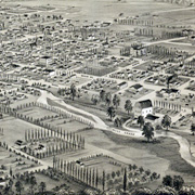
Bird’s eye view of Walla Walla, Washington Territory 1876. From the west, looking east.
We have seen great progress in our downtown, which has been rehabilitated, and has begun the renovation and reuse of second story space, an active farmer’s market, and a variety of public art—all goals Walla Walla 2020 (WW2020) has worked toward, along with others. Major national awards have been received, and more historic buildings and homes are being restored, as well as being honored by handsome plaques provided by WW2020, together with WW2020 research reports establishing the buildings’ history. Our periodic architectural awards have made a contribution to this renewal and blossoming process, honoring the restoration or renovation and reuse of historic buildings, compatible new construction, outstanding examples of energy conservation, landscaping, and public art. Recent progress has also been made through WW2020’s leadership in partnership with the Downtown Foundation in achieving Certified Local Government (CLG) status for the city of Walla Walla, and the establishment of the City of Walla Walla Historic Preservation Commission.
The Walla Walla 2020 Historic Research & Plaque Project continues to be very active. In addition to producing historic property reports and historic building plaques, an historic database has been created to digitalize all WW2020 research reports and make them accessible through an interactive map. The database incorporates all historic register properties in the area, as well as homes featured in Penny Andres’ books, courtesy of Fort Walla Walla Museum.
A new Historic Resources Coordinating Committee has also been formed, initially coordinated by the Chamber of Commerce, to assist the community in providing accurate historical information for publications about the area, and to identify gaps in current historic materials.
Several new initiatives involving historic resources have been undertaken through the leadership of WW2020 that relate to both cultural and economic development values. In 1998, a Heritage Corridor Management Plan for US Highway 12 from Snake River Bridge to Walla Walla was prepared for the Port of Walla Walla with National Scenic Byways grant funds. The plan recommends interpretive overlooks both at Wallula and at Frenchtown near the historic St. Rose Cemetery. Under WW2020’s leadership, Wallula Interpretive Overlook Partners has been organized, a major grant application has been submitted through US Fish & Wildlife Service in cooperation with Blue Mt. Audubon Society and others to create an interpretive site on the bank of the Columbia River just above Madame Dorion Park, and a small grant has been awarded to WW2020 by partner Union Pacific Railroad.
Another project involving historic resources in which WW2020 has taken the lead focuses on the Second Walla Walla Treaty Council and Stevens Skirmish which took place in September, 1856. These little known events were the subject of a workshop held at Walla Walla Community College, sponsored by WW2020. The purpose of the gathering of historians, archaeologists, tribal representatives, and other interested invitees was to attempt to locate these events by comparing historical accounts, as well as field visits to proposed locations, and to discuss possible commemorative activities during this sesquicentennial year. A volunteer archaeologist, Darby Staff from Battelle, has been recruited to lead the project, and an initial archaeological survey of a portion of the most likely site of the two-day fight between Gov. Isaac Stevens and area Indians was conducted. Further survey work is planned.
The last Walla Walla 2020 Community & Architecture Awards ceremony was held in Spring 2015.
Additional Resources
Research & Plaque Map
We’ve created an interactive map of area properties that have an associated Walla Walla 2020 Research Report and/or Plaque.
Request a Property Research Report
Interested in having your property researched? Download the brochure.
WW2020 Historic Sites & Markers Project
The goal of the Walla Walla 2020 Historic Sites & Markers Project is to honor unmarked Walla Walla area historic sites, most of which are unknown to the general public, by erecting interpretive signage and providing additional details about their significance through printed materials, public presentations and on our webpages.
Several sites have already been marked, and plans are underway for additional sites, dependent on available funding.
There’s still plenty left to do!
Use the contact form to find out how to get involved with Walla Walla 2020
Focus Area Chair
Daniel Clark
Walla Walla (WW) Area History:
- Bygone WW
- Dayton Historic Railroad Depot
- Fort WW Museum
- Frazier Farmstead Museum (Milton-Freewater, OR)
- Frenchtown Historic Site
- Historic WW Blog
- Kirkman House Museum
- Waitsburg Historical Society
- WW Historic Homes Trail Guide
- WW University E.L. Mabley Archives
- Whitman College Northwest Archives
- Whitman Mission