
History of 329-335 South Second Avenue, Walla Walla, WA
Property Description:
Beginning at a point in the Easterly line of Second Street in the City of Walla Walla, Washington, which point is 350 feet Southerly, measured along said Easterly line, from the point of intersection of same with the Southerly line of Birch Street in said city; thence Southerly along said Easterly line of Second Avenue South a distance of 82.4 feet; thence North 62º50’ East 20 feet; thence North 62º23’ East 25 feet; thence North 57º50’ East 28 feet; thence North 60º55’ East 47 feet to the Easterly limit of the land formerly owned by Catherine E. Stahl; thence South 29º50’ East to the North line of the land of W. P. Winans; thence North 60º10’ East along the Northerly line of the land of said Winans, to a point therein which is 150 feet Westerly of the Westerly line of First Avenue South in said city, measured along a line drawn parallel to said Southerly line of Birch Street; thence North 29º50’ West 85 feet to a point where a line drawn North 60º10’ East and through the point of beginning would intersect the same; thence South 60º10’ West 150 feet to the point of beginning.
ALSO, beginning at a point in the Easterly line of Second Avenue South in the City of Walla Walla, Washington which point is 266 feet southerly, measured along said Easterly line of Second Avenue South from the point of intersection thereof with the Southerly line of Birch Street; thence South 29º50’ East, along said Easterly line of Second Avenue a distance of 84.00 feet; thence North 60º10’ East 150.0 feet; thence North 29º50’ West 84.0 feet; thence South 60º10’ West 150.0 feet to the point of beginning.
ALSO, beginning at a point in the Easterly line of Second Avenue South in the City of Walla Walla, Washington which point is 485.5 feet Southerly, measured along said Easterly line of Second Avenue South, from the point of intersection thereof with the Southerly line of Birch Street in said city; thence North 29º50’ West, along said Easterly line of Second Avenue South, a distance of 53.10 feet; thence North 62º50’ East 20 feet; thence North 62º23’ East 25 feet, thence North 57º50’ East 28 feet; thence North 60º55’ East 47 feet; thence South 29º50’ East 51.0 feet, more or less, to a point which is North 59º51’ East 120 feet from the point of beginning; thence South 59.51’ West 120 feet to the point of beginning.
ALSO, beginning at a point in the Easterly line of Second Avenue South in the City of Walla Walla, Washington which point is 485.5 feet Southerly from the point of intersection of the said Easterly line of Second Street with the Southerly line of Birch Street in said City; thence North 59º51’ East 120 feet; thence South 29º50’ East 46.41 feet; thence South 60º10’ West 120 feet to the said Easterly line of Second Street; thence North 29º50’ West 45.75 feet to the point of beginning; situate in the City and County of Walla Walla, Washington.
ALSO, beginning at a point in the Easterly line of Second Avenue South in the City of Walla Walla, which point is 608 feet Southerly, measured along said Easterly line of Second Street from the point of intersection thereof with the Southerly line of Birch Street in said City; thence at right angles Easterly 120 feet; thence at right angles Southerly 38 feet; thence at right angles Westerly 120 feet to the Easterly line of Second Avenue South; thence Northerly on said Easterly line of Second Avenue South to the point of beginning; together with a right of way over ad across a strip of land adjoining to the South, said strip being 3.5 feet in width.
Title History:
Washington Territory was created in 1853. The new legislature created Walla Walla County in 1854 which stretched from the crest of the Cascade Mountains to the crest of the Rocky Mountains in the present states of Washington, Idaho and Montana. In 1855 an Indian council was held on the banks of Mill Creek at the present site of Walla Walla to purchase land from the Indians. The Yakima, Cayuse and Walla Walla tribes were dissatisfied with the treaties and war followed. Missionaries, former French-Canadian employees of the Hudson’s Bay Company trading post at Wallula, and soldiers at the military Fort Walla Walla were the primary European occupants of the area prior to 1859 when it was opened for settlement. All of the land in this area was acquired from the Cayuse and Walla Walla Indian tribes by the U.S. Government in a treaty signed on June 9, 1855 in Walla Walla, and ratified on March 8, 1859 by President James Buchanan.
Walla Walla was originally laid out by County Surveyor H. H. Case in 1859, before its formal incorporation as a city in 1862, as a one-quarter mile square with its eastern side centered on the point where Main Street crossed Mill Creek (at roughly the point where it does now). The City of Walla Walla received a Trustee Townsite from the U. S. Government which consisted of 80 acres issued on July 20, 1869 by the Vancouver, W.T. District Land Office. Main Street originally followed the old Nez Perce Indian Trail. Consequently the streets leading off of it were at right angles to it, and were not in a north-south orientation. This was corrected as the city moved eastward which gave Walla Walla its peculiar street pattern with the three street intersection at Palouse, Boyer and Main Streets. To the original plat, additional parcels were annexed from time to time, usually with the name of the land owner of record at the time the additions were made.
A 120 acre homestead claim that included this property was filed by John and Margaret Sparks and Frederik Saddler which was not recorded until September 6, 1872. However John Sparks sold 2.32 acres of his claim on October 18, 1864 to Ludwell J. Rector including this property. On June 24, 1865 Mr. Rector signed an agreement with Emil Meyer for the right to construct a mash mill on this property and use water from Robert’s Creek (now called Lincoln Creek) for the next 5 years. This property is just south of the original 1869 plat of the City of Walla Walla. It is also at the corner of section and quarter section lines that do not align with either Second Street or Birch Street. This explains the complex legal descriptions that sometimes define property lines in this block by the long-ago adjacent land owners. There were also a significant number of court cases involving this property which were not investigated and may not be reflected in this chain of title.
Ludwell J. and Jane Rector sold this property to R. R. and Augusta Rees on July 10, 1865 for $600. Rees had launched the first issue of the Washington Statesman newspaper on November 29, 1861. On October 8, 1869 Rees sold this and more property to John N. Foster for $1000. On November 20, 1886 Albert Foster signed a quit claim deed for $1000 to his father for his portion of this property which he inherited from his mother Margaret J. Foster, who died prior to 1880. John Henry Foster died on September 27, 1907. His heirs continued to own this property (and file several law suits regarding it, including one in 1924 filed by his granddaughter, Murl Starr) until Alvin A. King, guardian for Lewis Foster, signed a party wall agreement with A. K and Flora Dice and I. W. and Adelia B. Sims on February 15, 1911, forty-two years after Foster’s purchase of this triangle of early Walla Walla. This party wall was to be 16 inches wide along the south property line, brick with concrete foundations and two-stories tall starting at the street and extending back 120 feet.
In 1914 there was a Sheriff’s Deed under Foreclosure on multiple properties. On May 19, 1924 the Walla Walla County Treasurer recorded Treasurer’s Tax Deeds to many previously foreclosed properties including this 84’ by 150’ lot. On October 14, 1924 Murl Starr sued the heirs of John Foster, A.K. Dice, I. W. Sims and D. V. Woods for one-twelfth of her grandfather’s estate. After more court cases the Walla Walla County Treasurer signed a deed to this property to John Alheit. Rather obliquely the next legal transaction affecting this property was the dissolution of White Brothers Inc. on March 9, 1945 when ownership of that business reverted to members of the White family. On April 2, 1945 O. A. White, E. A. White, T. Willard White and Mervin Leonard sold this 84 x150 foot lot to Pioneer Brewing, formerly United Union Brewery Co. On April 23, 1947 Pioneer Brewing Co. by W. D. Bryan, president, and Howard J. Williams, secretary, sold this property to Howard J. Williams and Elmer G. Williams of Tacoma for $2000. On May 29, 1947 the Williams sold this property including the 1911 party wall agreement to William R. O’Rourke, Sr. O’Rourke signed two promissory notes of $9000 each payable to Oakley Taylor, J. W. and Myrtle F. Ray, secured by the rents from this property.
On December 21, 1956 W. R. and Jean O’Rourke gave an undivided 1/4 interest in this property to Winifred Lane for “love and affection.” At this same time they gave a similar interest to W. R. O’Rourke, Jr. On June 29. 1960 Bernice and W. R. O’Rourke Jr. deeded an undivided 1/4 interest in the property to W. R. O’Rourke Co. Inc. On June 4, 1965 W. R. O’Rourke Co. Inc gave an undivided 1/4th share to Bernice and W. R. O’Rourke, Jr. On October 6, 1970 Winifred (Lane) Meisner gave a deed on three parcels including this one to Bernice and W. R. O’Rourke, Jr. William R. O’Rourke Jr. died in 1984. Bernice O’Rourke, his widow and personal representative of his estate, signed a Deed of Personal Representative to Bernice O’Rourke and Nancy B. Henderson for an undivided one-half of this property. On December 15, 1999 Bernice O’Rourke signed a Quit Claim Deed on this property in favor of the O’Rourke Family LLC.
Occupant History:
329 South Second:
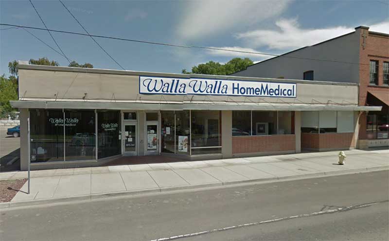
In 1951 #329 appeared in the city directories for the first time with a listing for Ray’s Cleaners. The cleaners continued in this location until 1969 when this address was listed as vacant. In 1971 #329 was occupied by the Center for Family Planning until Planned Parenthood took over in 1977 though 1980. In 1983-1986 this address was the location of G & L Mechanical Corp. and Custom Automotive. In 1988 it became the location of Walla Walla Home Medical until the present.
331 South Second:
Number 331 first appeared in the city directory in 1951 as the address of the Commercial Credit Corp. In 1956 it was occupied by Beauty Art. In 1958 it was Ave Press. In 1961 Peter Lucas, Chiropractor, rented this space through 1972. In 1974 it was rented by the Local 556 Teamsters & Cannery Workers though 1985. In 1991 New Horizons was the tenant here. In 1994 the directory showed this address as “unlisted.”
333 South Second:
The first entry in the reverse city directory to list 333 S. Second was in 1949 when the Walla Walla Book Store was located here until 1953. National Cash Register Co. was located in #333 from 1954 until their last listing at this address in 1961. In 1978 to 1980 Anderson-Perry and Associates Inc. with Keith Olson, manager, occupied this address.
335 South Second:
In 1956 through 1980 the U. S. Social Security Administration occupied #335. In 1981 it became U. S. Health and Human Resources at this location through 1987. In 1988 #335 was occupied by New Horizons until they moved to #331 in 1991. In 1993 Walla Walla Mental Health opened an office in this location. In 1995 it was occupied by Walla Walla Mental Health, Children and Families. In the last published city directory in 1997 the occupant at #335 was Walla Walla Mental Health Adult Training Program.
Construction of the Building:
The Walla Walla County Tax Assessor lists four buildings in the same tax parcel, including the two brick buildings south of the buildings researched for this report. The buildings in this report are described by the Tax Assessor as a one-story 18 foot high structure listed as “community service building” built in 1920, plus a one-story, 12 foot high structure listed as a “retail store” built in 1922. Nothing was found in the chain of title to suggest when these one-story cement block buildings were constructed. They are not shown on the fire map which was updated in 1946. However, William R. O’Rourke Sr. purchased this property in 1947 and the first listing of any of these addresses in the city directories was 1949 so it is reasonable to assume O’Rourke built them in 1948.
References:
Bennett, Robert A., Walla Walla Portrait of a Western Town 1804-1899, Pioneer Press, Walla Walla, 1980.
Bennett, Robert A., Walla Walla A Town Built to be a City 1900-1919, Pioneer Press, Walla Walla, 1982.
Building Permits: Whitman College Penrose Library Archives.
Lyman, Professor W.D., An Illustrated History of Walla Walla County 1901.
Ogle’s Standard Atlas of Walla Walla County, 1909
Sanborn Fire Maps: 1884-1905 (with updates until 1950).
Walla Walla City Directories: 1880-present (various publishers–not all years).
Whitman College Archives.
Mary E. Meeker ; Walla Walla 2020 Research Service PO Box 1222, Walla Walla WA 99362 October, 2011


