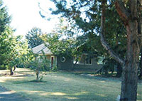
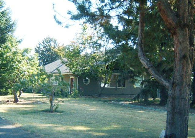
History of 2609 Cottonwood Road, Walla Walla, WA
Property Description:
In Walla Walla County, State of Washington
Parcel A:
Beginning at a point in the east line of the Ransom Clark Donation Claim, according to the official plat thereof recorded in volume B of plats at page 56, records of Walla Walla County, which point is south 0º 16′ west 1298.0 feet, measured along the east line of said Donation Claim from the northeast corner thereof; thence continuing south 9º 16′ west, along the east line of said Donation Claim, 207.85 feet; thence north 78º 23″east 323.79 feet; thence north 11º 43′ 33″ west 145.69 feet; thence west 286.58 feet to the point of beginning. EXCEPTING therefrom such part of said premises as lies within the county road along the west side thereof. Being Tract A as designated on Short Plat filed April 22, 1977, in book 1 of Short Plats, page 68, as Auditor’s no. 564144.
Parcel B:
Beginning at a point in the east line of the Ransom Clark Donation Claim, according to the official plat thereof recorded in volume B of plats at page 56, records of Walla Walla County, which point is south 0º 16′ west 1505.85 feet, measured along the east line of said Donation Claim from the northeast corner thereof; thence north 78º 23′ east 323.79 feet; thence south 11º 43′ 33″ east 84.0 feet; thence south 78º 47′ west 60.0 feet; thence south 5º 35′ west 118.86 feet; thence north 87º 26′ west 264.71 feet to a point in the east line of said Donation Claim; thence north 0º 16′ east along said east line 135.15 feet to the point of beginning. EXCEPTING therefrom such part of said premises as lies within the county road along the west side thereof.
Being Tract B as designated on Short Plat filed April 22, 1977, in book 1 of Short Plats, page 68, as Auditor’s no. 564144.
Title History:
Washington Territory was created in 1853. The new legislature created Walla Walla County in 1854 which stretched from the crest of the Cascade Mountains to the crest of the Rocky Mountains in the present states of Washington, Idaho and Montana. In 1855 a treaty council was held on the banks of Mill Creek at the present site of Walla Walla to purchase land from the Indians. The Yakimas, Cayuses and Walla Wallas were dissatisfied with the treaties and war followed. Missionaries, former French-Canadian employees of the Hudson Bay Company trading post at Wallula, and soldiers at the military Fort Walla Walla were the primary European occupants of the area prior to 1859 when it was opened for settlement. All of the land in this area was acquired from the Cayuse and Walla Walla Indian tribes by the U.S. Government in a treaty signed on June 9, 1855 in Walla Walla, and ratified on March 8, 1859 by President James Buchanan.
Walla Walla was originally laid out by County Surveyor H. H. Case in 1859, before its formal incorporation as a city in 1862, as a one-quarter mile square with its eastern side centered on the point where Main Street crossed Mill Creek (at roughly the point where it does now). The City of Walla Walla received a Trustee Townsite from the U. S. Government which consisted of 80 acres issued on July 20, 1869 by the Vancouver, W.T. District Land Office. Main Street originally followed the old Nez Perce Indian Trail. Consequently the streets leading off of it were at right angles to it, and were not in a north-south orientation. This was corrected as the city moved eastward which gave Walla Walla its peculiar street pattern with the three street intersection at Palouse, Boyer and Main Streets. To the original plat, additional parcels were annexed from time to time, usually bearing the name of the land owner of record at the time the additions were made.
The local families involved in this title include several with many interrelated members in several generations. The first legal transaction in Walla Walla County records on this property was on September 29, 1877 when Michael B. and Amelia E. Ward sold 466 acres to Thomas Page for $10,000. These early property descriptions were complex with measurement in chains. On October 12, 1882 Thomas P. and Ellen Page sold land including this property to William Hammond for $20,600. Hammond and Nancy Hancock sold 154.6 acres to J. M. Reser on October 23, 1896 for $4500. John M. Reser was born in 1865 and married Martha (Mattie) in 1885. Their daughter Julia married Mike Toner and they were the parents of Wilbur and Mabelle Toner. Hammond died in 1900, and there were multiple transactions involving Hammond heirs, including water rights, leases, quit claim deeds and court cases. On January 8, 1902 Nancy Hancock and multiple Hammond heirs signed Quit Claim deeds to J. M. Reser on 154.6 acres.
On September 10, 1902 Permelia Hammond signed an indenture to Wilbur Toner for $20,000, including water rights. On January 15, 1913 Wilbur A. and Mabelle H. Toner transferred some of this property to Joseph W. Toner for $10. On December 12, 1921 John M. and Mattie J. Reser, apparently in financial difficulty, signed a trust deed in favor of multiple beneficiaries including W. A. Toner for creditor claims on multiple rural and urban properties. This began a series of confusing transfers related to collections and the clearing of title claims.
On January 5, 1922 Joseph W. and Permelia Toner signed a Warranty Deed to Arthur E. and Mary Hunt. On January13, 1923 Sheriff Charles J. Springer gave a Certificate of Purchase of Real Estate to Gardener and Company, Inc. for bid of $722.77. On April 5, 1924 W. A Toner, Trustee for J. M. Reser and certified creditors of December 12, 1921 signed a Warranty Deed on multiple properties to Herbert Ringhoffer, a bachelor. On April 8, 1924 J. M. and M. J. Reser signed a Quit Claim Deed to Wilbur Toner on multiple properties. On April 26, 1924 Herbert Ringhoffer signed a Quit Claim Deed to W. A. Toner on multiple properties. On October 26, 1925 Arthur E. and Mary Hunt signed a Warranty Deed to Roy H. and Myrtle Cecil for 28.66 acres, water rights, ditches and dams. On March 25, 1925 W. A. and Mabelle H. Toner signed a Quit Claim Deed to Loren and Fannie Reser. On November 11, 1926 Loren Reser signed a Quit Claim Deed to Wilbur A. Toner. On the same day Fannie Reser gave a Warranty Deed to her husband, Loren Reser. On August 24, 1927 Roy and Myrtle Cecil signed a Warranty Deed to Carol Hayden, a widow. On September 22, 1927 John and Mattie Reser signed a Quit Claim Deed to Carol Hayden, a widow, to clear a clouded title. On July 30, 1928 Carol Hayden signed a Warranty Deed to J. W. and Jessie Hastings, subject to the balance of a mortgage owed to Frank Lockwood. On November 15 Hazel Hastings Adams signed a Quit Claim Deed to Jessie Hastings, widow. On November 29, 1929 Roy H. Cecil filed a Certificate of Water Right on Russell Creek.
The next 13 years were spent in legal proceedings until Walter M. Kern received a Sheriff’s Deed on February 20, 1934 for $1330.47. Walter M. Kern was Superintendent of the Walla Walla Public Schools and lived at 1205 Alvarado Terrace in 1933. On April 21, 1934 Walter and Carolyn Kern signed a deed on this property to Glen and Edith Krallman “with appurtenances.” In 1933 Krallman was a barber who lived at 705 4th Avenue. By 1937 they lived at FRD 3, presumable at this location. On May 17, 1934 Jessie Hastings signed a Warranty Deed to Charles & Mary Enzeroth. Krallman signed a Quit Claim Deed to Charles and Mary Enzeroth on May 16, 1939. He was described as a farmer on Cottonwood Road. On June 3, 1942 Enzeroth signed a Warranty Deed for “$1” to Harlan A. and Clara D. Miller. The next day Harland signed a Quit Claim Deed giving this property to his wife, Clara. On June 13, 1958 their son, Harlan Davis Miller, for the Estate of Harlan Abbott Miller sold this property to Austin J. and Cozette E. Roberts for $24,255. The 1960 City Directory listed A. Roberts at Route 3, Box 332, Powerline Road. On September 25, 1977 Cozette and the Estate of Austin Roberts sold this property to Lyle G. and Shirley Krull. On March 1, 1991 Krulls sold to John H. and Nora O. Bleth. On May 21, 1993 Cozette Roberts gave Tract C of this property to St. Paul’s Church.
Construction of the Building:
The Walla Walla Count Tax Assessor’s records list a construction date of 1915. This would have been when Joseph Toner owned the property and before the complex legal proceedings of 1921 and later. The city directories show Joseph Toner living south of town on RFD Route #3 on 10 acres in the same section as this property in 1902 with an assessed valuation of $1000 and in 1904 with an assessed value of $1400. The 1909-10 directory has no listing for Joseph Toner. The 1910-11 directory, released and copyrighted in 1910, again lists Joseph Toner, now with a home on Park Street estimated to be ¼ mile south of the cemetery. This listing continues in the 1911-12 directory, describing the property for the first time as a dairy and listing a wife (Amelia), which is repeated in the 1912-13, 1914 with a valuation of $2060, and 1915 with assessed valuation increasing to $2830. After that the valuation drops to $2250 for 38 acres in 1916-17, $1800 in 1918, and $1750 in 1920. In the 1921-22 directory, Joseph W. and Permilia Toner are listed as living at 366 Chase in the city with an assessed valuation of $2400.
Though the county assessor gives a construction date of 1915 for this home, these are often estimates. Since the first listing for Joseph Toner on what appears to be this property is in the directory published in 1910, and he obtained title to the property on January 13,1913, it appears appropriate to list a construction date for this since-remodelled home as “circa 1910.”
It is worth noting that many of the title holders listed above were members of various branches of the same extended and intermarried family.
References:
Andres, Penny, Walla Walla Her Historic Homes, 1991.
Bennett, Robert A., Walla Walla Portrait of a Western Town 1804-1899, Pioneer Press, Walla Walla, 1980.
Bennett, Robert A., Walla Walla A Town Built to be a City 1900-1919, Pioneer Press, Walla Walla, 1982.
Lyman, Professor W.D., An Illustrated History of Walla Walla County 1901.
Walla Walla City Directories: 1880-present (various publishers–not all years).
Whitman College Archives.
Mary E. Meeker, Daniel N. Clark
dawame@bmi.net; 525-4135
Walla Walla 2020 Research Service
PO Box 1222, Walla Walla WA 99362
November, 2014


